Check out how collaboration is supporting landscape-scale species recovery, forest health, fire resilience, and habitat restoration across the state.
Asian Pacific Environmental Network, 2021
Calls for proactive investment in social infrastructure to close climate gaps and build community resilience.
- Details
-
This report offers recommendations on initial steps to build resilient communities throughout California. If taken, these steps would represent an unprecedented effort to close the climate gap and invest in social infrastructure for climate resilience. The urgent need to bolster community resilience should be viewed as an opportunity to rethink the political, social, and economic structures needed to safeguard all California residents.
United Nations Development Programme, November 2021
Explores how protected areas support biodiversity and global goals for living in harmony with nature.
- Details
-
Protected areas (PAs) are essential tools for biodiversity conservation. Area-based conservation is recognized as a crucial component for achieving a nature positive future, for the resilience of the planet and biodiversity, as well as for humanity. Now, the process for developing the post-2020 Global Biodiversity Framework is underway, with the framework set to be adopted at the fifteenth meeting of the Conference of the Parties (COP) to the Convention, with a 2050 vision of “living in harmony with nature”.
California Invasive Plant Council and California Landscape Stewardship Network, October 2020
Highlights the need for coordinated, well-funded EDRR systems to combat invasive plants and protect California’s biodiversity.
- Details
-
In 2018, then-Governor Jerry Brown established the California Biodiversity Initiative, setting biodiversity protection as a top state priority. The Biodiversity Collaborative is the next phase in the evolution of California’s biodiversity conservation movement, integrating and building on efforts started by the California Biodiversity Initiative launched by Governor Brown. Like California’s State Wildlife Action Plan and Climate Adaptation Strategy, the Biodiversity Collaborative identifies the importance of controlling invasive species as part of attaining a sustainable future.
Indeed, hundreds of entities across California are engaged in strategic efforts to limit the scope and magnitude of the damage that these species do to the state’s biodiversity and natural resources. When possible, land managers use a strategic approach called early detection and rapid response (EDRR) that focuses on stopping new invasive plants before they become widespread. As with a raging wildfire, a surging infectious disease, or a leaking oil pipeline, the longer one waits to act, the more difficult and costly the task and the greater the damage that has already been done.While the concept is simple, its implementation is complex. Effective EDRR requires timely data, proactive effort, landscape-level coordination among public and private landowners, and a consistent and sustained approach. In California, many pieces of an effective EDRR system are already in place, from an online network for sharing botanical information to a statewide network of land managers. But steady funding to implement EDRR systematically across the state’s 100 million acres is lacking. With the new Biodiversity Collaborative in place, the time has come for an increased commitment to invasive plant EDRR.
While technical challenges remain—such as predicting how each plant’s distribution will shift with land use and climate change—EDRR’s primary challenges are structural: How can agency missions, mandates, programs, and funding be aligned to support landscape-level conservation? This paper identifies the institutional and financial support needed for invasive plant EDRR to succeed in California.

One Tam, 2020
Details One Tam’s cross-jurisdictional EDRR program to manage invasive plants and protect Mt. Tamalpais ecosystems.
- Details
-
Invasive plants don’t see our property lines. The five partners that make up Marin County’s One Tam partnership know this, and they teamed up to create an Early Detection Rapid Response (EDRR) program tasked with identifying and managing weeds spanning the jurisdictions on Mt. Tamalpais. The EDRR team released this full report on its work from the first survey cycle, offering deep analysis of survey efforts and offering detailed strategies for addressing the mountain’s most formidable weeds. The early detection work is a cornerstone to One Tam’s efforts to protect the mountain’s iconic landscapes, and the plants and animals that call them home.
Mammoth Lakes Trails and Public Access Foundation, 2020
Presents a vision for collaborative recreation and conservation planning across California’s public lands.
- Details
-
Sponsored and initiated by the Mammoth Lakes Trails and Public Access Foundation (MLTPA), the CALREC Vision project is working to highlight the essential, multi-benefit role that outdoor recreation plays in California. MLTPA has been engaged with local and regional issues of sustainable recreation and collaboration in California's Eastern Sierra since its inception and provides technical support to a regional public/public recreation-based solution, the Eastern Sierra Sustainable Recreation Partnership. Given its role employing collaboration to improve the social, environmental, and economic impacts of recreation in the Eastern Sierra, MLTPA invites you to visit mltpa.org to learn more about our work.
In launching the CALREC Vision Project, MLTPA engaged counsel from an array of federal, state, and regional agency and organizational experts as an Advisory Committee. Participants in the Advisory Committee generously shared their time, perspective, and advice on these topics through a series of facilitated, virtual meetings from May 2020 through July 2020. The results of those productive meetings were focused discussions and agreement about the need for cross-jurisdictional collaboration, as virtually every participant expressed encountering similar challenges. Participants also helped identify areas where collaboration can advance sustainable outdoor recreation goals within their respective agencies and organizations and throughout California.
One Tam, 2019
Provides a living protocol for invasive plant monitoring used by One Tam agencies to guide EDRR efforts.
- Details
-
Developed in 2016 and subsequently revised, this Early Detection Rapid Response protocol serves the invasive plant monitoring needs of the One Tam agencies. While this protocol is in routine use at One Tam, it is also a living document, with occasional changes to the species list or other elements.
November 2019
Outlines scalable methods to assess ecological health, prioritize management, and inspire action using Mt. Tamalpais as a model.
- Details
-
Fundamental to understanding how to manage and steward the natural world, raise awareness, or inspire action is being able to describe how your resources are faring and what needs intervention, and to do so in a credible and compelling way.
One way that natural resource-based agencies, organizations, or partnerships may choose to do this is through an assessment of the state of their resources. While these “ecological health assessments” are often initially developed to create a baseline against which future change can be measured, they can also focus management priorities, educate the public, generate action, and/or increase financial or political support.
The process described here is based on what we did for Mt. Tamalpais. This is one approach you can use, but because every effort will be different, we have tried to make the process scalable—describing a more comprehensive and involved method followed by possible alternative approaches. Each reader will need to assess how, or if, to apply this advice to their own project. That said, we have called out key decision points for elements we feel are truly fundamental, no matter what approach you choose to take.
California Landscape Stewardship Network, 2018
Examines visitor management challenges and solutions to balance access, experience, and ecological health in popular California parks.
- Details
-
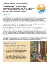
In June 2018, staff from the Lake Tahoe Basin, the Golden Gate National Recreation Area, Tamalpais Lands Collaborative and Point Lobos gathered at Muir Woods National Monument for a conversation on visitor capacity, public access, and traffic management. Muir Woods recently eliminated a large percentage of road-side parking along the narrow entrance to the park and implemented a reservation system for parking after overcrowding and traffic in the monument came to an untenable level. In Lake Tahoe, managers are facing a similar situation on their roadways and recreation areas basin-wide, particularly in hot spot attractions such as Emerald Bay State Park. Point Lobos is experiencing similar challenges with managing increased visitor use.
As Lake Tahoe and Point Lobos explore solutions to its congestion and resource protection challenges, staff found it very valuable to learn from the approaches used at Muir Woods, including (1) how the Monument looked at capacity and its effect on visitor experience, (2) what infrastructure changes were made to meet the changed visitor management approach at the Monument, (3) how the public engagement process was designed, specifically its adaptability to community and political issues and the hiring of a dedicated individual, and (4) key lessons learned on the public rollout of the new system.
US Department of Interior, January 2017
Outlines DOI policy to conserve sagebrush ecosystems and greater sage-grouse habitat through coordinated action.
- Details
-
This chapter from the Department of Interior (DOI) Manual establishes Departmental policy in compliance with the Secretary’s Order 3336, Rangeland Fire Prevention, Management, and Restoration, and provides guidance to bureaus/offices for implementing measures to conserve and restore the integrity of the sagebrush biome, including greater sage-grouse habitat.
Blue Earth Consultants, November 2016
Evaluates conservation grants’ effectiveness in protecting Bay Area habitats and enabling strategic interventions.
- Details
-
The overarching goal of the Bay Area conservation portfolio is to protect and preserve native habitat and species in the Bay Area. The Gordon and Better Moore Foundation promotes conservation and protection of Bay Area land and achieves its overarching goal through supporting projects throughout 10 counties: Alameda, Contra Costa, Marin, Napa, San Francisco, San Mateo, Santa Clara, Santa Cruz, Solano and Sonoma.
In September 2015, the foundation saw the value in an external evaluation that would seek to answer two difficult questions: assessing stewardship outcomes and variability for local lands protected with Moore Foundation funding, and determining the impact of enabling intervention funding. The foundation hired Blue Earth Consultants, LLC (Blue Earth) to conduct the evaluation. Blue Earth served as the prime contractor and led a multi-disciplinary team including sub-contractors Jenn Fox, Jodi M. McGraw (Jodi McGraw Consulting), and Stuart B. Weiss (Creekside Center for Earth Observation). The following report summary includes a synthesis of the evaluation results organized in four main sections: 1) an overview of the evaluation objectives, questions, and methods used throughout the evaluation; 2) a discussion of the overarching impact of the portfolio; 3) a synthesis of results regarding stewardship outcomes achieved by land protection grants; and 4) a synthesis of results regarding the impact of enabling intervention grants.